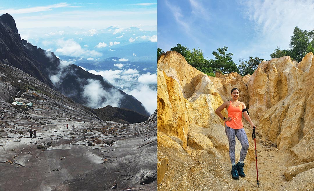
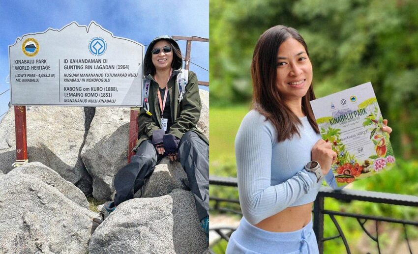
About to embark on climbing Mount Kinabalu’s summit for yourself? Well, if you’re wondering what it’s like to summit Malaysia’s highest peak, then here are all the photos you’ll need to see. (Images by author.)
It was a trip almost a year in the making. My uncle and I had trained for about eight months before we were supposed to scale Malaysia’s highest peak — Mount Kinabalu. The highest peak in Southeast Asia outside the Himalayan range and the third-highest mountain peak on an island in the world, Mount Kinabalu, towers at 4,095 metres (or 13,435 feet). While it’s barely half the height of the world’s tallest mountains, getting to its summit is still a feat in itself.
So, to train, we regularly hit our local hiking trails. We were a bunch of mountaineering noobs training on a mission. Sadly, two days before our big climb, COVID-19 reared its ugly head at us, and I wound up climbing that mountain alone. Well, sort of. I’d only ever met some of the rest of our hiking group once or twice before, but despite that, I was in good company.
One thing I’d really wanted to know before the climb was what it would be like. Yes, it was uphill all the way. Yes, it was steep. Yes, there were steps. Yes, there were ropes. But unless you’ve been up there yourself, what is the two-day ascent really like? I (somehow and just barely) made it to the top and made my way back down in one piece to be able to tell you just that.
Timpohon Gate to Panalaban Basecamp
Depending on your fitness levels, the hike from Timpohon Gate to Panalaban Basecamp takes between five to seven hours, and there are seven rest huts along the way. Distances between each hut vary for those wondering.
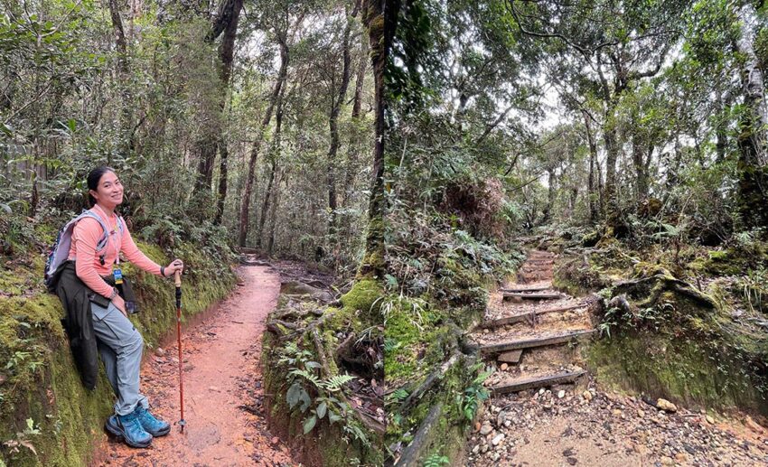
One thing I’d noticed on my ascent is how the surrounding foliage changed around me, so let’s start from the bottom.
Pushing off from Timpohon Gate, at 1,866 metres (6,122 feet), the trees at this point are similar to those you’d see on a regular hike in and around the Klang Valley — lush and tropical. Meanwhile, the steps are muddy when wet but well-built, so you needn’t worry about slipping.
In between your second and third stops — Pondok Ubah (2,032 metres or 6,666 feet) and Pondok Lowii (2,262 metres or 7,421 feet) — the skies quite literally open up, so if you have a cap or visor, be sure to wear it on a particularly sunny day. You’ll also notice the foliage beginning to change while the terrain gets rockier. By this point, you’re already at an elevation of well over 2,000 metres, so signs of the tropics begin to fade away.
Walking through here feels like a fairytale – it’s almost magical, even. Just look at the mossy forest surroundings!

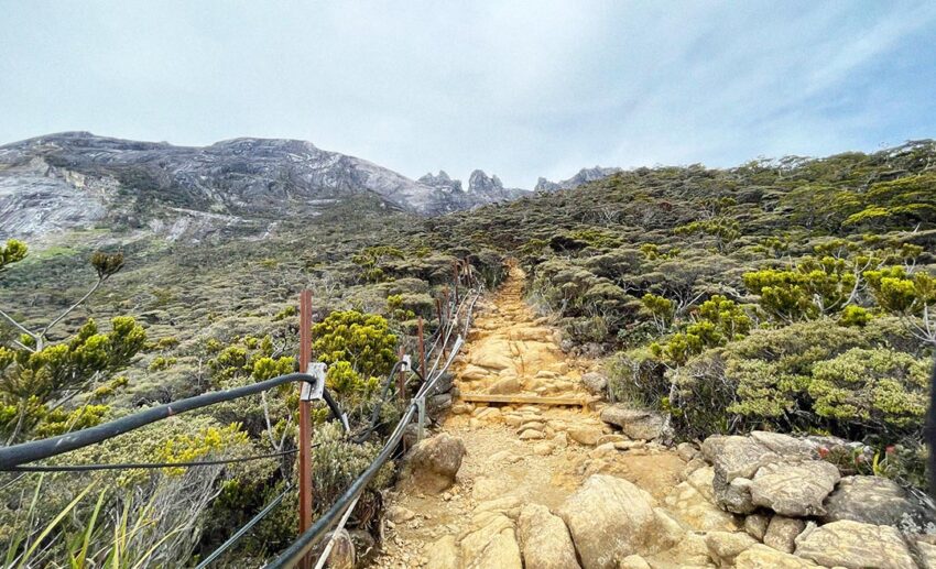
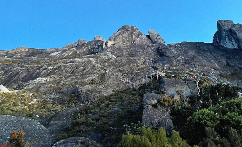
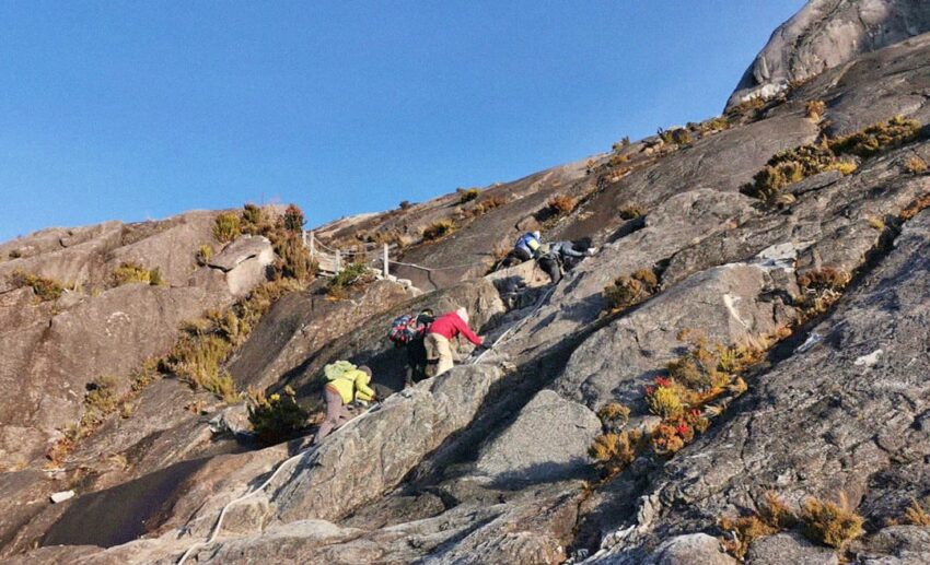
Once you’ve passed Pondok Mempening (2,490 metres or 8,169 feet) and Pondok Layang Layang (2,691 metres or 8,829 feet), which is the trail’s main rest stop, it gets pretty rocky from here on out. There will be one or two bits where you’ll find ropes hooked in place for you to gain leverage and pull yourself up.
Looking at descending climbers zip down past me, I was shocked at how quickly they were going as it felt so steep, and I was nervous about how slippery the rocks might be. But later on, when I myself was descending, I zipped right past too. Oddly enough, it didn’t feel steep at all and at no point did I use the ropes. Although, of course, you should if at any time you feel off balance. They’re there for your safety, and better to be safe than to try and be a hero.
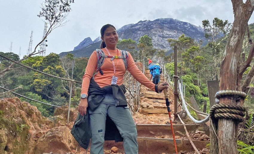
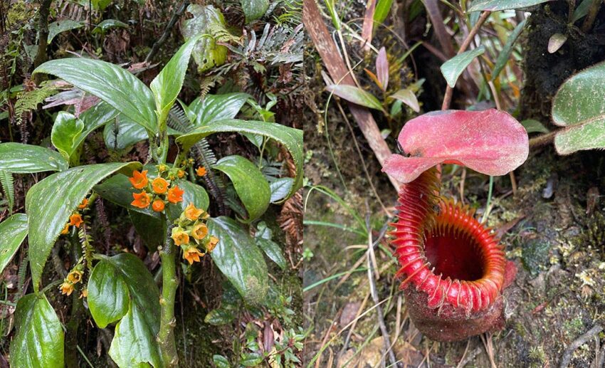
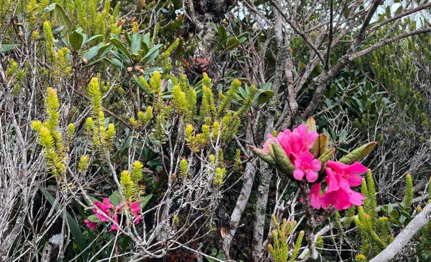
Now, onto the penultimate hut and rest stop before we reach Panalaban Basecamp — Pondok Villosa (2,961 metres or 9,714 feet). You’ll notice an abundance of pitcher plants on the way here, while the trees have changed to sub-alpine plants and taller trees. There are also blooms galore that you wouldn’t normally spot growing back down at sea level.
The air and climate are also more temperate, and the mountain’s rocky expands feels like you’ve suddenly been transported to a far-away oriental garden in a more temperate clime.
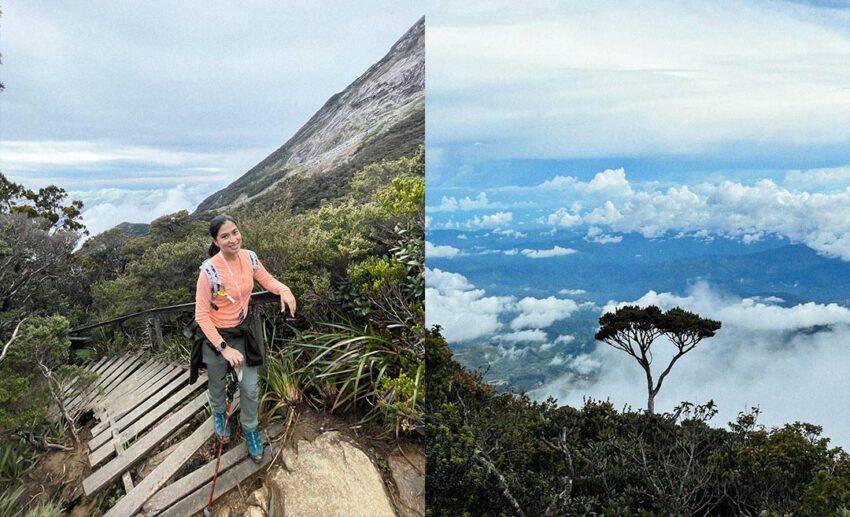
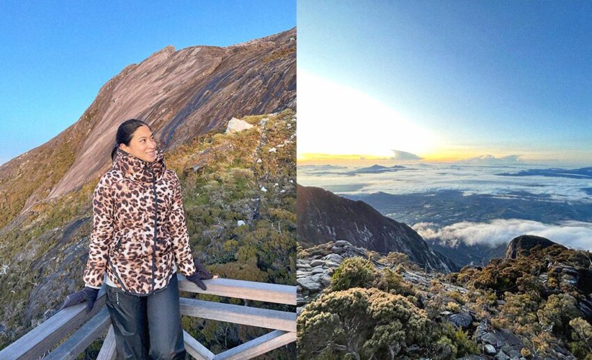
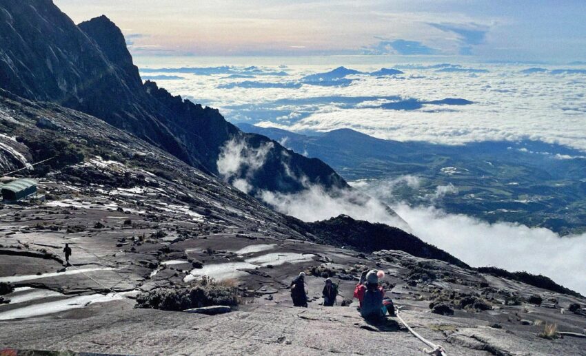
You’ll also quickly notice that you’re well above the clouds now, which sure makes a sight for sore eyes! Definitely worth stopping every now and then for a break and some awesome photos.
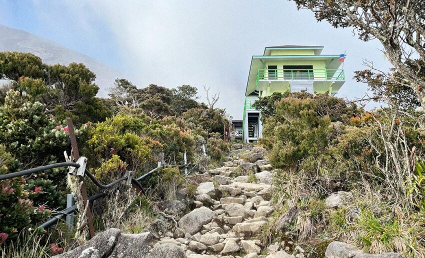
Not far away is the last shelter of the Timpohon Trail — Pondok Paka (3,080 metres or 10,105 feet). By this point, you’re just stepping over one rock and then another to finally reach Panalaban, that’s just 500 metres away. However, this isn’t a quick and easy half-kilometre. Take 20 steps, then rest for 30 to 40 seconds before taking another 20 steps. Rinse and repeat till you finally get to basecamp.
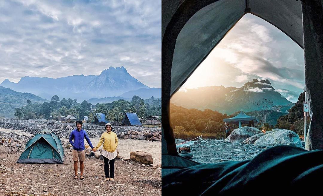
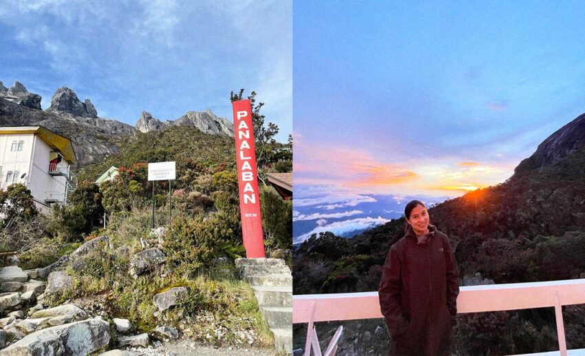
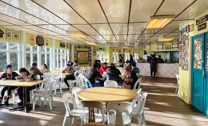
Once you’re at Panalaban, you’ll need to check into Laban Rata Resthouse to find your assigned room. Then, relax for the evening, enjoy the sunset from the Laban Rata veranda, and tuck in early for the night. Tomorrow’s going to be a doozy! Well, it was for me, anyway.
The summit attack
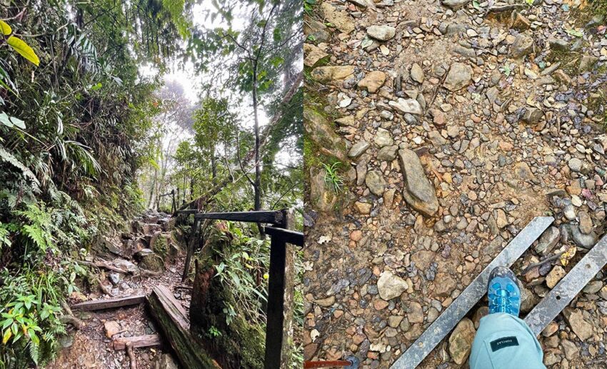
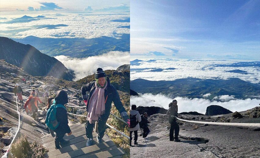
Rise and shine! The usual time to push off from Panalaban for the summit attack is between 2am and 3am. For this particular stretch, we’re climbing up in pitch darkness, so I don’t have anything to show you. What I can tell you, though, is that there are heaps of steps all the way up to a viewing point halfway to your final checkpoint.
The steps are well made and maintained, although they can be a bit narrow, so do tread carefully in the darkness; the steps are made with wood, and there are railings all along the way for you to hold on.
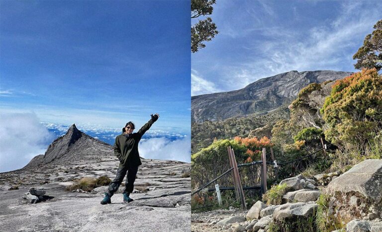
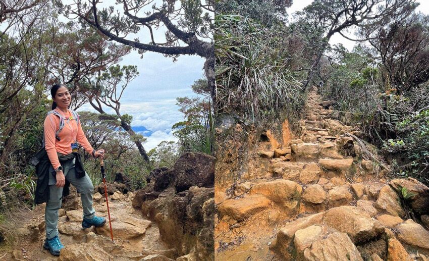
Finally, we’re at Sayat-Sayat (3,668 metres or 12,034 feet), the final checkpoint before reaching Mount Kinabalu’s summit. Here, you need to make sure that you check in with the security personnel at the huts so that they know you’ve attempted the summit attack.
From here on out to the summit, there are some steps, but really, it’s nothing but rocky terrain and open space. The sun can also be intense here as the surrounding foliage rapidly disappears, and you’re more or less climbing out in the open. Of course, there are plenty of ropes all the way. Coming down, I realise that the ropes are also there to help guide you back down. Especially when it rains; as the fog gets so dense, you won’t see a thing more than a few feet ahead of you. If it’s still dark when you reach this point, the white rope also acts as a reflective guide. So, charge those headlamps!
Climbers may also find it difficult to finish that last 1 kilometre with the thinning air and potential Acute Mountain Sickness (AMS). The best advice I can give you? Take your time and trust your guide. They’ll be there to help get you to the top. It’s really more of a mental game than a physical one at this juncture.
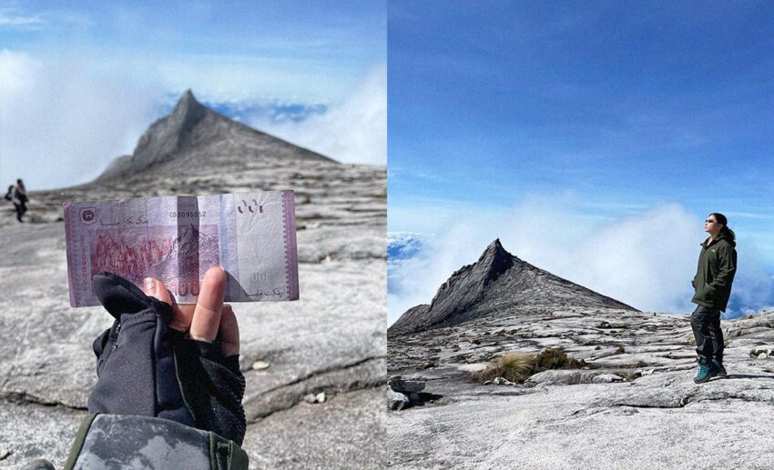
On your way up to the summit, you’ll see the famous South Peak that’s emblazoned onto our RM100 notes and a great photo op, so stop for a bit and relax here.
And now, it’s the final push to the top. At one point, my AMS was getting so severe that my guide asked if I wanted to turn around and return, promising that I’d still get my full certificate since I was only about 200 metres from the summit.
Even in all my delirium, I managed to think for a minute and decided no. I’m going to reach the top. I knew that if I didn’t do it, I’d feel like I’d cheated myself and not feel deserving of that coloured certificate. So, off I went, berkepit with my guide, and he near dragged me up there. But I made it.
Of course, the adventure doesn’t end here, as you still have to make your way back down. But truth be told, going down is gravy. Just remember to go easy on your knees and use your hiking poles. It’s time to celebrate.